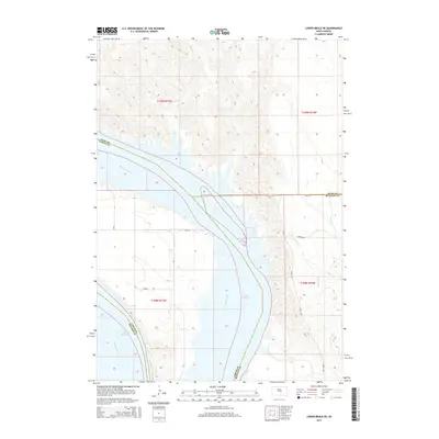
2015 Map of Lower Brule NE
USGS Topo · Published 2015About this map
Lake Sharpe dominates this 2015 landscape where the Missouri River flows through the intersection of four South Dakota counties. The geography is defined by significant administrative and tribal boundaries, marking the meeting points of Hyde, Lyman, Hughes, and Buffalo counties. This topography reflects the modern management of the river system, showing the reservoir's expansive reach across traditional prairie lands.
Find a feature on this map
17 named features on this map. Tap any name to fly to it.
Don’t see what you’re looking for? This feature index may not catch every label — zoom into the map to look around manually.
Map Details
Editions of this 2015 Lower Brule NE Map
This is the sole edition of this map. No revisions or reprints were ever made.
Other maps of this area

1953 · Huron
USGS Topo · 1:250,000

1954 · Huron
USGS Topo · 1:250,000

1966 · Lower Brule NW
USGS Topo · 1:24,000

1966 · Stephan
USGS Topo · 1:24,000

1966 · Big Bend Dam
USGS Topo · 1:24,000

1966 · Lower Brule SW
USGS Topo · 1:24,000

1966 · Lower Brule NE
USGS Topo · 1:24,000

1966 · Lower Brule
USGS Topo · 1:24,000

1973 · Chapelle Lake SE
USGS Topo · 1:24,000

1973 · Chapelle Lake SW
USGS Topo · 1:24,000
Featured Places
- Big Bend District, SD
- Fort Thompson District, SD
- Grey Hill West Township, Fort Thompson District
- Hughes County, SD
- Buffalo County, SD