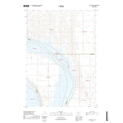
2017 Map of Lower Brule NE
USGS Topo · Published 2017About this map
Lake Sharpe dominates this section of the Missouri River valley, where the reservoir's wide reach meets the intricate drainages of the Big Bend District. The map details a complex intersection of tribal and county boundaries, including the borders of Hyde, Hughes, Lyman, and Buffalo counties. On the eastern shore, the topography is defined by the winding course of Soldier Cr and numerous smaller draws that cut through the bluffs. The modern road network reflects local culture and history through uniquely named routes such as Soup & Frybread Rd and Poachers Ln, which provide access to the riverfront alongside BIA Rte 3 and Little Bend Rd. This survey documents the contemporary shoreline and rural infrastructure within the tribal lands of central South Dakota.
Find a feature on this map
16 named features on this map. Tap any name to fly to it.
Don’t see what you’re looking for? This feature index may not catch every label — zoom into the map to look around manually.
Map Details
Editions of this 2017 Lower Brule NE Map
This is the sole edition of this map. No revisions or reprints were ever made.
Other maps of this area

1953 · Huron
USGS Topo · 1:250,000

1954 · Huron
USGS Topo · 1:250,000

1966 · Lower Brule NW
USGS Topo · 1:24,000

1966 · Stephan
USGS Topo · 1:24,000

1966 · Big Bend Dam
USGS Topo · 1:24,000

1966 · Lower Brule SW
USGS Topo · 1:24,000

1966 · Lower Brule NE
USGS Topo · 1:24,000

1966 · Lower Brule
USGS Topo · 1:24,000

1973 · Chapelle Lake SE
USGS Topo · 1:24,000

1973 · Chapelle Lake SW
USGS Topo · 1:24,000
Featured Places
- Big Bend District, SD
- Fort Thompson District, SD
- Grey Hill West Township, Fort Thompson District
- Hughes County, SD
- Buffalo County, SD