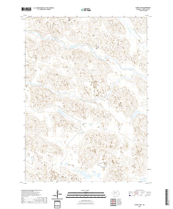
2021 Map of Lowes Lake
USGS Topo · Published 2021About this map
North Loup River meanders across this Cherry County landscape, carving through the sandhills and creating the broad Wamaduze Valley to the northeast. This 2021 survey documents a region of sparse settlement where local history is anchored by family and community burial sites. Significant genealogical markers include the Dewitty Cem, a rare physical trace of the early 20th-century African American homesteading community once known as Audacious. The presence of the Long Cem and the solitary Emanuel Gravesite further illustrate the isolated nature of these rural townships. Water remains the primary geographical driver for land use, with drainage from Wamaduze Cr and Big Cr feeding into the river system, while Lowes Lake sits as a prominent feature in the southern portion of the quadrangle.
Find a feature on this map
15 named features on this map. Tap any name to fly to it.
Don’t see what you’re looking for? This feature index may not catch every label — zoom into the map to look around manually.
Map Details
Editions of this 2021 Lowes Lake Map
This is the sole edition of this map. No revisions or reprints were ever made.
Other maps of this area

1948 · Seneca
USGS Topo · 1:62,500

1948 · Seneca 4
USGS Topo · 1:62,500

1949 · Seneca 4
USGS Topo · 1:62,500

1951 · Seneca
USGS Topo · 1:62,500

1951 · Bull Lake
USGS Topo · 1:62,500

1951 · Brownlee
USGS Topo · 1:62,500

1957 · Valentine
USGS Topo · 1:250,000

1959 · Valentine
USGS Topo · 1:250,000

1985 · Goose Creek
USGS Topo · 1:100,000
1985 · Mule Lake
USGS Topo · 1:24,000