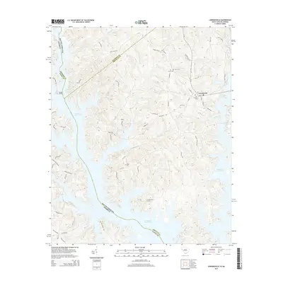
2014 Map of Lowndesville
USGS Topo · Published 2014About this map
The town of Lowndesville stands at a high point in Abbeville County, overlooking a landscape dramatically defined by the expansive Richard B Russell Lake. This reservoir, formed along the border of South Carolina and Georgia, has submerged many of the historical valley features, but the map still identifies significant upland landmarks including Gregg Shoals and the Diamond Spring. The local geography is marked by numerous creeks and branches, such as Charlies Cr, Bond Cr, and Bowman Br, which feed into the lake's intricate shoreline. For those researching family history in the area, several burial sites remain on the high ground, including Smyrna Cem, Providence Cem, Ridge Cem, and the Old McCalla Cem. The map illustrates the contemporary road network, including SC-81 and several locally named routes like Pringle Clinkscale Rd and Gregg Shoals Rd, which connect these rural communities.
Find a feature on this map
68 named features on this map. Tap any name to fly to it.
Don’t see what you’re looking for? This feature index may not catch every label — zoom into the map to look around manually.
Map Details
Editions of this 2014 Lowndesville Map
This is the sole edition of this map. No revisions or reprints were ever made.
Other maps of this area

1893 · Elberton
USGS Topo · 1:125,000

1954 · Greenville
USGS Topo · 1:250,000

1958 · Greenville
USGS Topo · 1:250,000

1958 · Elberton
USGS Topo · 1:62,500

1959 · Hartwell Dam
USGS Topo · 1:24,000

1964 · Iva
USGS Topo · 1:24,000

1964 · Antreville
USGS Topo · 1:24,000

1964 · Lowndesville
USGS Topo · 1:24,000
1964 · Calhoun Falls
USGS Topo · 1:24,000
1964 · Latimer
USGS Topo · 1:24,000