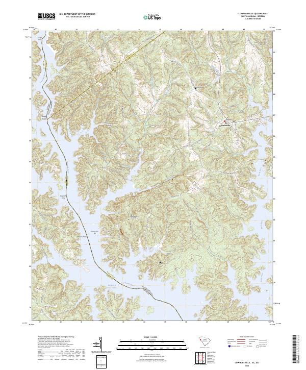
2024 Map of Lowndesville
USGS Topo · Published 2024About this map
Lowndesville serves as the primary settlement on this landscape where the Savannah River basin meets the border of Georgia. The terrain is defined by the expansive Richard B Russell Lake, which has significantly altered the historic riverfront where Crafts Ferry, Bowman Ferry, and Harpers Ferry once operated. These ferry crossings, along with Gregg Shoals, point to a long history of river-based transport and navigation before the modern reservoir era.
Find a feature on this map
74 named features on this map. Tap any name to fly to it.
Don’t see what you’re looking for? This feature index may not catch every label — zoom into the map to look around manually.
Map Details
Editions of this 2024 Lowndesville Map
This is the sole edition of this map. No revisions or reprints were ever made.
Other maps of this area

1893 · Elberton
USGS Topo · 1:125,000

1954 · Greenville
USGS Topo · 1:250,000

1958 · Greenville
USGS Topo · 1:250,000

1958 · Elberton
USGS Topo · 1:62,500

1959 · Hartwell Dam
USGS Topo · 1:24,000

1964 · Iva
USGS Topo · 1:24,000

1964 · Antreville
USGS Topo · 1:24,000

1964 · Lowndesville
USGS Topo · 1:24,000
1964 · Calhoun Falls
USGS Topo · 1:24,000
1964 · Latimer
USGS Topo · 1:24,000