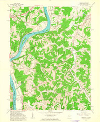
1961 Map of Lubeck
USGS Topo · Published 1963About this map
Ohio River navigation and the rugged hills of the West Virginia-Ohio border define this 1961 landscape. The river is a primary corridor, marked by the industrial presence of Lock and Dam No 20 and the Baltimore and Ohio railroad skirting the banks near Humphrey. Inland, the terrain breaks into numerous ridges and hollows, such as New England Ridge and Ghost Run, where small family-named settlements and cemeteries are scattered. Genealogists will find a wealth of records in the numerous burial grounds, including the Schultz Cem, Munchmeyer Cem, and Fort Belleville Cem. The map captures the transition from the river bottomlands at Washington Bottom to the protected woodlands of the Wayne National Forest, revealing a rural economy built on the timber and oil potential of the Appalachian plateau.
Find a feature on this map
112 named features on this map. Tap any name to fly to it.
Don’t see what you’re looking for? This feature index may not catch every label — zoom into the map to look around manually.
Map Details
Editions of this 1961 Lubeck Map
4 editions found

Other maps of this area

1902 · Parkersburg
USGS Topo · 1:62,500

1904 · Parkersburg
USGS Topo · 1:62,500

1904 · Chesterhill
USGS Topo · 1:62,500

1906 · Belleville
USGS Topo · 1:62,500

1906 · Chesterhill
USGS Topo · 1:62,500

1907 · Keno
USGS Topo · 1:62,500

1924 · Belleville
USGS Topo · 1:62,500

1926 · Belleville
USGS Topo · 1:62,500

1949 · Clarksburg
USGS Topo · 1:250,000

1956 · Clarksburg
USGS Topo · 1:250,000