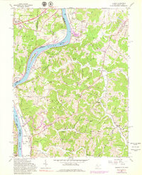
1961 Map of Lubeck
USGS Topo · Published 1979About this map
Washington Bottom and the fertile river terraces of Belpre define this reach of the Ohio River as it was surveyed in the late 1950s and early 1960s. The landscape reflects a mix of heavy industrial potential and deep-rooted agricultural settlement, with the Baltimore and Ohio railroad skirting the riverbanks near Torch. Numerous family cemeteries, such as Munchmeyer Cem and Boso Cem, are scattered across the ridges, providing a detailed record for genealogical research in Wood County and across the state line in Athens and Washington counties.
Find a feature on this map
111 named features on this map. Tap any name to fly to it.
Don’t see what you’re looking for? This feature index may not catch every label — zoom into the map to look around manually.
Map Details
Editions of this 1961 Lubeck Map
4 editions found

Other maps of this area

1902 · Parkersburg
USGS Topo · 1:62,500

1904 · Parkersburg
USGS Topo · 1:62,500

1904 · Chesterhill
USGS Topo · 1:62,500

1906 · Belleville
USGS Topo · 1:62,500

1906 · Chesterhill
USGS Topo · 1:62,500

1907 · Keno
USGS Topo · 1:62,500

1924 · Belleville
USGS Topo · 1:62,500

1926 · Belleville
USGS Topo · 1:62,500

1949 · Clarksburg
USGS Topo · 1:250,000

1956 · Clarksburg
USGS Topo · 1:250,000