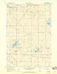
1967 Map of Lucan
USGS Topo · Published 1968About this map
Lucan serves as the primary hub of this Redwood County landscape, situated along the Chicago and Northwestern rail line. The surrounding territory is defined by an intensive network of drainage infrastructure, including Judicial Ditch No 92, County Ditch No 60, and Judicial Ditch No 31, which transformed the prairie for agriculture. Natural water features like the Redwood River in the north and Sleepy Eye Creek in the south provide a contrast to the engineered grid. Conservation efforts are evident in the Rohlik State Wildlife Management Area and Westline State Wildlife Management Area, which preserve wetland pockets amidst the cultivated fields. Numerous Gravel Pits dot the area, indicating the local extraction industry used for road building, while specific infrastructure markers like Br 1049 provide precise points for historical engineering research.
Find a feature on this map
22 named features on this map. Tap any name to fly to it.
Don’t see what you’re looking for? This feature index may not catch every label — zoom into the map to look around manually.
Map Details
Editions of this 1967 Lucan Map
This is the sole edition of this map. No revisions or reprints were ever made.
Other maps of this area

1953 · New Ulm
USGS Topo · 1:250,000

1957 · New Ulm
USGS Topo · 1:250,000

1958 · New Ulm
USGS Topo · 1:250,000

1962 · School Grove Lake
USGS Topo · 1:24,000

1962 · Milroy SE
USGS Topo · 1:24,000

1962 · Milroy
USGS Topo · 1:24,000

1965 · Echo
USGS Topo · 1:24,000

1965 · Belview
USGS Topo · 1:24,000

1967 · New Ulm
USGS Topo · 1:250,000

1967 · Wabasso SE
USGS Topo · 1:24,000