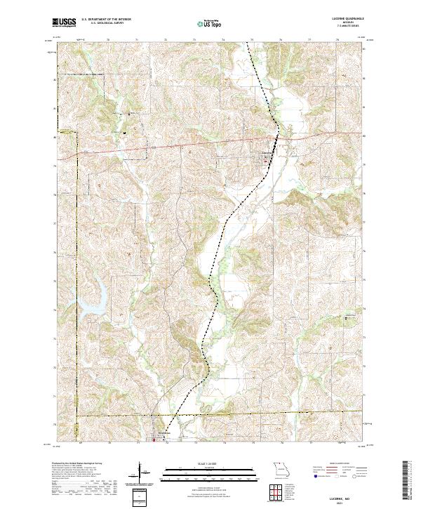
2021 Map of Lucerne
USGS Topo · Published 2021About this map
Medicine Creek and its many tributaries, including Elm Branch and Barber Creek, define the rolling landscape of this northern Missouri border region. The village of Lucerne sits at a crossroads in Putnam County, while the settlement of Newtown is situated further south near the Sullivan County line. This area shows a persistent pattern of rural life and land use, with the Mercer County line cutting through the western portion of the map. Genealogists will find several burial grounds noted across the terrain, such as Busby Cemetery and the nearby Old Busby Cemetery, which hint at the generations of families who settled these creek valleys. The drainage systems of West Locust Creek and its smaller branches create a complex network of ridges and hollows that have historically dictated the placement of early roads and farmsteads.
Find a feature on this map
46 named features on this map. Tap any name to fly to it.
Don’t see what you’re looking for? This feature index may not catch every label — zoom into the map to look around manually.
Map Details
Editions of this 2021 Lucerne Map
This is the sole edition of this map. No revisions or reprints were ever made.
Other maps of this area

1942 · Seymour
USGS Topo · 1:62,500

1944 · Seymour
USGS Topo · 1:62,500

1954 · Centerville
USGS Topo · 1:250,000

1957 · Centerville
USGS Topo · 1:250,000

1958 · Centerville
USGS Topo · 1:250,000

1964 · Pollock NW
USGS Topo · 1:24,000

1964 · Ravanna
USGS Topo · 1:24,000

1964 · Harris
USGS Topo · 1:24,000

1964 · Half Rock
USGS Topo · 1:24,000
1964 · Pollock SW
USGS Topo · 1:24,000