
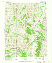
1964 Map of Lucerne
USGS Topo · Published 1965About this map
Medicine Creek flows south through the center of this northern Missouri landscape, shaping the terrain of York and Medicine townships. The village of Lucerne sits along the Chicago Milwaukee St Paul and Pacific railroad, which cuts through the hills toward Newtown in the southwest corner. The map reflects a deeply established rural community with several family-named landmarks and historical sites, including the Old Busby Cem and the West Putnam Sch in the northeast. Small watercourses like Barber Creek, Lick Branch, and Long Branch create a dissected topography of ridges and valleys typical of the region's agricultural layout. These features, along with the Howard Cem near West Locust Creek, provide essential landmarks for genealogists and local historians documenting the early families of Putnam and Sullivan counties.
Find a feature on this map
22 named features on this map. Tap any name to fly to it.
Don’t see what you’re looking for? This feature index may not catch every label — zoom into the map to look around manually.
Map Details
Editions of this 1964 Lucerne Map
This is the sole edition of this map. No revisions or reprints were ever made.
Other maps of this area

1942 · Seymour
USGS Topo · 1:62,500

1944 · Seymour
USGS Topo · 1:62,500

1954 · Centerville
USGS Topo · 1:250,000

1957 · Centerville
USGS Topo · 1:250,000

1958 · Centerville
USGS Topo · 1:250,000

1964 · Pollock NW
USGS Topo · 1:24,000

1964 · Ravanna
USGS Topo · 1:24,000

1964 · Harris
USGS Topo · 1:24,000

1964 · Half Rock
USGS Topo · 1:24,000
1964 · Pollock SW
USGS Topo · 1:24,000