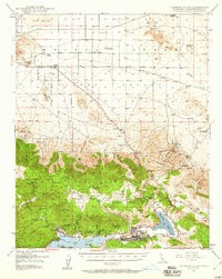
1947 Map of Lucerne Valley
USGS Topo · Published 1960About this map
San Bernardino Mountains rise sharply above the high desert floor in this late 1940s survey, illustrating a landscape defined by the transition from arid flats to timbered heights. The northern half is dominated by Lucerne Dry Lake and the Pickaninny Buttes, where remote outposts like the Box S Ranch and the Midway Sch served a sparse ranching community. Further south, the terrain climbs into the gold-bearing districts of Holcomb Valley, a region once booming with activity. Numerous sites like the Doble Mine (Aband) and Blackhawk Mine (Aband) indicate a legacy of resource extraction that shaped the local geography. At the southern edge, the developing community of Big Bear City sits on the shores of Big Bear Lake, showcasing the early infrastructure of this alpine retreat, including a Landing Strip and the Big Bear Lake Ranger Sta.
Find a feature on this map
73 named features on this map. Tap any name to fly to it.
Don’t see what you’re looking for? This feature index may not catch every label — zoom into the map to look around manually.
Map Details
Editions of this 1947 Lucerne Valley Map
5 editions found
Other maps of this area

1899 · Redlands
USGS Topo · 1:62,500

1901 · Southern California Sheet No. 1
USGS Topo · 1:250,000

1901 · Redlands
USGS Topo · 1:62,500

1902 · Deep Creek
USGS Topo · 1:62,500

1902 · San Gorgonio
USGS Topo · 1:125,000

1904 · Southern California Sheet No. 1
USGS Topo · 1:250,000

1932 · Barstow
USGS Topo · 1:125,000

1934 · Barstow
USGS Topo · 1:125,000

1947 · Lucerne Valley
USGS Topo · 1:62,500

1949 · Lucerne Valley
USGS Topo · 1:62,500