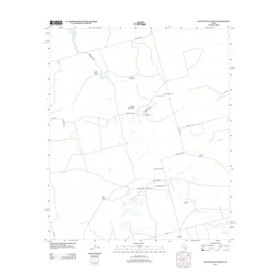
2012 Map of Lucian Wells Ranch
USGS Topo · Published 2012About this map
Large cattle ranching operations define this West Texas landscape, dominated by the extensive Lucian Wells Ranch and its private aviation facility, the Edwards Lucian Wells Ranch Airport. The terrain is characterized by an intricate network of named watercourses including Mustang Draw, Polecat Cr, and Panther Cr, which dictate the placement of ranch infrastructure. Local navigation relies on a series of numbered private and county roads such as Ranch Road 818 and McDowell Rd, linking the primary headquarters at Hall Ranch and McDowell Ranch. A distinctive feature of this era’s water management is the dense concentration of named wind pumps, including the curiously titled School Bus Windmill, West Field Windmill, and Polecat Windmill, which serve as vital landmarks across the open range near Buzzards Bend.
Find a feature on this map
28 named features on this map. Tap any name to fly to it.
Don’t see what you’re looking for? This feature index may not catch every label — zoom into the map to look around manually.
Map Details
Editions of this 2012 Lucian Wells Ranch Map
This is the sole edition of this map. No revisions or reprints were ever made.
Other maps of this area

1941 · Morita
USGS Topo · 1:62,500

1941 · Big Spring South
USGS Topo · 1:62,500

1942 · Big Spring South
USGS Topo · 1:62,500

1949 · Morita
USGS Topo · 1:62,500

1954 · Big Spring
USGS Topo · 1:250,000

1954 · San Angelo
USGS Topo · 1:250,000

1958 · San Angelo
USGS Topo · 1:250,000

1958 · Big Spring
USGS Topo · 1:250,000

1963 · Ballinger Ranch
USGS Topo · 1:24,000

1964 · Dewey Lake NE
USGS Topo · 1:24,000