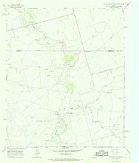
1966 Map of Lucian Wells Ranch
USGS Topo · Published 1968About this map
The Howard Co Glasscock Co boundary line bisects this 1960s landscape, where cattle ranching and early petroleum extraction defined the local economy. Deep in the heart of the Permian Basin, the terrain is characterized by the meandering courses of Mustang Draw, Panther Creek, and Polecat Creek. Settlement patterns are concentrated around family-named operations including the Lucian Wells Ranch, McDowell Ranch, and Hall Ranch, reflecting the enduring legacy of large-scale landholdings in West Texas.
Find a feature on this map
21 named features on this map. Tap any name to fly to it.
Don’t see what you’re looking for? This feature index may not catch every label — zoom into the map to look around manually.
Map Details
Editions of this 1966 Lucian Wells Ranch Map
This is the sole edition of this map. No revisions or reprints were ever made.
Other maps of this area

1941 · Morita
USGS Topo · 1:62,500

1941 · Big Spring South
USGS Topo · 1:62,500

1942 · Big Spring South
USGS Topo · 1:62,500

1949 · Morita
USGS Topo · 1:62,500

1954 · Big Spring
USGS Topo · 1:250,000

1954 · San Angelo
USGS Topo · 1:250,000

1958 · San Angelo
USGS Topo · 1:250,000

1958 · Big Spring
USGS Topo · 1:250,000

1963 · Ballinger Ranch
USGS Topo · 1:24,000

1964 · Dewey Lake NE
USGS Topo · 1:24,000