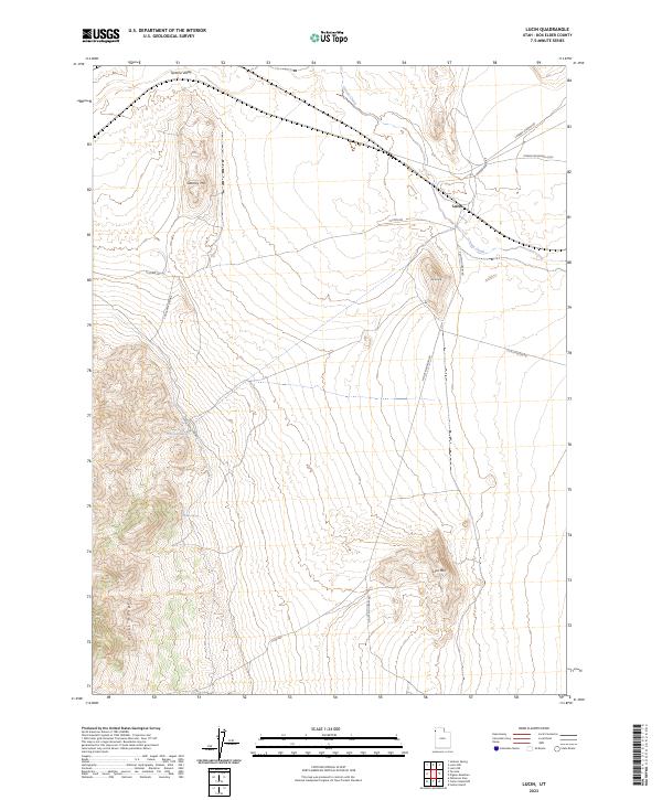
2023 Map of Lucin
USGS Topo · Published 2023About this map
Lucin remains the central point of reference in this high-desert landscape of western Box Elder County. The terrain is defined by the steep elevation of the Pilot Range to the southwest and prominent peaks including Gartney Mtn and Lion Mtn. Hydrological features like Indian Spring and Coal Bank Springs provide essential water points in an otherwise arid basin. The transportation network reflects the area's isolation and utility, with the Pigeon Mountain Loop and Pilot Mountain Rd providing access to the sprawling flats of the Tecoma Valley. This data, compiled from recent Bureau of Land Management and National Hydrography Dataset sources, illustrates a remote region where historical transit routes and sparse natural springs dictate the human footprint on the land.
Find a feature on this map
17 named features on this map. Tap any name to fly to it.
Don’t see what you’re looking for? This feature index may not catch every label — zoom into the map to look around manually.
Map Details
Editions of this 2023 Lucin Map
This is the sole edition of this map. No revisions or reprints were ever made.
Other maps of this area

1954 · Brigham City
USGS Topo · 1:250,000

1955 · Wells
USGS Topo · 1:250,000

1958 · Wells
USGS Topo · 1:250,000

1958 · Brigham City
USGS Topo · 1:250,000

1961 · Wells
USGS Topo · 1:250,000

1962 · Brigham City
USGS Topo · 1:250,000

1967 · Jackson Spring
USGS Topo · 1:24,000

1967 · Pigeon Mountain
USGS Topo · 1:24,000

1967 · Lucin
USGS Topo · 1:24,000

1967 · Patterson Pass
USGS Topo · 1:24,000