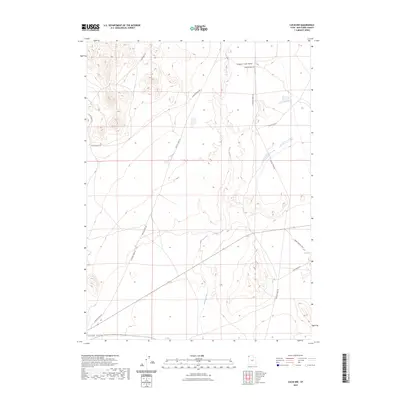
2023 Map of Lucin NW
USGS Topo · Published 2023About this map
Grouse Creek Valley and Tecoma Valley define the landscape of this remote portion of Box Elder County, where seasonal water and high-desert basins dictated the paths of early travel. The network of local roads, such as S Tom Cabin Rd, Winter Cabin Rd, and Kilgore Basin Rd, suggests a history of ranching and land management tied to these specific drainages. The central corridor is occupied by Grouse Creek, which meanders south through the valley floor, creating a vital riparian zone in an otherwise arid environment. Along the eastern edge, Owl Spring and the Rabbit Springs Loop indicate the significance of scattered water sources for livestock and local inhabitants. This survey provides a precise modern look at how these established routes and geographic features remain the primary landmarks in a sparsely populated region of northwestern Utah.
Find a feature on this map
13 named features on this map. Tap any name to fly to it.
Don’t see what you’re looking for? This feature index may not catch every label — zoom into the map to look around manually.
Map Details
Editions of this 2023 Lucin NW Map
This is the sole edition of this map. No revisions or reprints were ever made.
Other maps of this area

1954 · Brigham City
USGS Topo · 1:250,000

1955 · Wells
USGS Topo · 1:250,000

1958 · Wells
USGS Topo · 1:250,000

1958 · Brigham City
USGS Topo · 1:250,000

1961 · Wells
USGS Topo · 1:250,000

1961 · Dairy Valley
USGS Topo · 1:62,500

1962 · Brigham City
USGS Topo · 1:250,000

1967 · Jackson Spring
USGS Topo · 1:24,000

1967 · Pigeon Mountain
USGS Topo · 1:24,000

1967 · Lucin
USGS Topo · 1:24,000