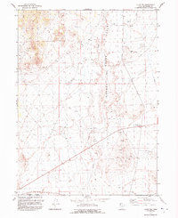
1992 Map of Lucin NW
USGS Topo · Published 1992About this map
Grouse Creek Valley and Tecoma Valley meet in this high desert landscape, captured during a 1991 map revision. The area is defined by its intermittent drainage patterns and industrial activity, most notably at Grouse Creek Junction where road networks converge. Evidence of mineral exploration is scattered across the terrain, including several Prospects, a Mine, and multiple Gravel Pits that suggest a history of localized extraction.
Find a feature on this map
15 named features on this map. Tap any name to fly to it.
Don’t see what you’re looking for? This feature index may not catch every label — zoom into the map to look around manually.
Map Details
Editions of this 1992 Lucin NW Map
This is the sole edition of this map. No revisions or reprints were ever made.
Other maps of this area

1954 · Brigham City
USGS Topo · 1:250,000

1955 · Wells
USGS Topo · 1:250,000

1958 · Wells
USGS Topo · 1:250,000

1958 · Brigham City
USGS Topo · 1:250,000

1961 · Wells
USGS Topo · 1:250,000

1961 · Dairy Valley
USGS Topo · 1:62,500

1962 · Brigham City
USGS Topo · 1:250,000

1967 · Jackson Spring
USGS Topo · 1:24,000

1967 · Pigeon Mountain
USGS Topo · 1:24,000

1967 · Lucin
USGS Topo · 1:24,000