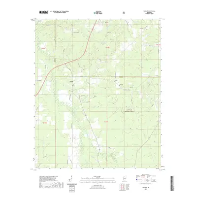
2021 Map of Ludlow
USGS Topo · Published 2021About this map
The Pearl River marks the northwestern corner of this landscape, where the borders of Leake and Scott counties meet. Centered on the settlement of Ludlow, the area is defined by the dense drainage network of Coffee Bogue and its tributaries, including Beach Cr and Little Beach Cr. This map documents a region where timber and agriculture intersect, with the northern reaches of the Bienville National Forest covering the southeastern quadrant.
Find a feature on this map
60 named features on this map. Tap any name to fly to it.
Don’t see what you’re looking for? This feature index may not catch every label — zoom into the map to look around manually.
Map Details
Editions of this 2021 Ludlow Map
This is the sole edition of this map. No revisions or reprints were ever made.
Other maps of this area

1922 · Morton
USGS Topo · 1:48,000

1922 · Pelahatchee
USGS Topo · 1:48,000

1924 · Pelahatchee
USGS Topo · 1:62,500

1924 · Morton
USGS Topo · 1:62,500

1950 · Pelahatchie
USGS Topo · 1:62,500

1951 · Morton
USGS Topo · 1:62,500

1952 · Pelahatchie
USGS Topo · 1:62,500

1953 · Meridian
USGS Topo · 1:250,000

1957 · Meridian
USGS Topo · 1:250,000

1960 · Sharon
USGS Topo · 1:62,500