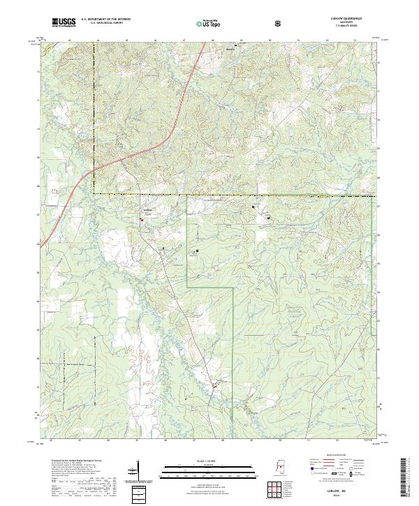
2024 Map of Ludlow
USGS Topo · Published 2024About this map
Ludlow stands as the primary settlement in this corner of Scott County, where the landscape transitions into the protected woodlands of the Bienville National Forest. The topography is defined by a dense network of tributaries including Coffee Bogue, Good Hope Branch, and Crookedwood Branch, which carve through the timberlands. To the north, the small settlement of Bertice marks the upper reaches of the map near the Leake County line. Family history is well-represented through several rural burial grounds such as Mount Zion Cem, Pearson Cem, and McDonald Cem. The road network, featuring names like Cowardtown Rd and Charles Latham Rd, suggests a long history of local land ownership and timber access within the forest boundaries.
Find a feature on this map
62 named features on this map. Tap any name to fly to it.
Don’t see what you’re looking for? This feature index may not catch every label — zoom into the map to look around manually.
Map Details
Editions of this 2024 Ludlow Map
This is the sole edition of this map. No revisions or reprints were ever made.
Other maps of this area

1922 · Morton
USGS Topo · 1:48,000

1922 · Pelahatchee
USGS Topo · 1:48,000

1924 · Pelahatchee
USGS Topo · 1:62,500

1924 · Morton
USGS Topo · 1:62,500

1950 · Pelahatchie
USGS Topo · 1:62,500

1951 · Morton
USGS Topo · 1:62,500

1952 · Pelahatchie
USGS Topo · 1:62,500

1953 · Meridian
USGS Topo · 1:250,000

1957 · Meridian
USGS Topo · 1:250,000

1960 · Sharon
USGS Topo · 1:62,500