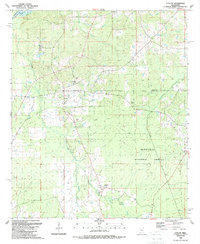
1989 Map of Ludlow
USGS Topo · Published 1989About this map
Ludlow and its surrounding wetlands occupy a central position in this survey of the northern Mississippi interior. The landscape is defined by the winding course of Bogue Chitto and Beach Creek, which drain toward the Pearl River at the western boundary. This territory is characterized by a mix of agricultural clearings and the dense timber of the Bienville National Forest, where local history is preserved in several family-named landmarks.
Find a feature on this map
32 named features on this map. Tap any name to fly to it.
Don’t see what you’re looking for? This feature index may not catch every label — zoom into the map to look around manually.
Map Details
Editions of this 1989 Ludlow Map
This is the sole edition of this map. No revisions or reprints were ever made.
Other maps of this area

1922 · Morton
USGS Topo · 1:48,000

1922 · Pelahatchee
USGS Topo · 1:48,000

1924 · Pelahatchee
USGS Topo · 1:62,500

1924 · Morton
USGS Topo · 1:62,500

1950 · Pelahatchie
USGS Topo · 1:62,500

1951 · Morton
USGS Topo · 1:62,500

1952 · Pelahatchie
USGS Topo · 1:62,500

1953 · Meridian
USGS Topo · 1:250,000

1957 · Meridian
USGS Topo · 1:250,000

1960 · Sharon
USGS Topo · 1:62,500