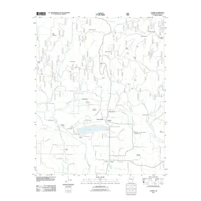
2011 Map of Ludwig
USGS Topo · Published 2011About this map
Lake Ludwig and its namesake settlement anchor this portion of Johnson County, where the Ozark foothills meet industrial and agricultural interests. The landscape is defined by the drainage of Spadra Creek and Minnow Creek, punctuated by significant family and community landmarks like the Stillwell Cemetery, Old King Cemetery, and Johnson Cemetery. Local industry is evidenced by the Ludwig Gas Field to the south, while the University of Arkansas Experimental Farm near Holloway Pond Dam points to the area's role in regional research. Notable terrain features such as Turkey Mountain, Red Lick Mountain, and the prominent Williams Bluff overlook a network of county roads and local loops like Strawberry Loop and Sleepy Hollow Ln. Small settlements such as Hillcrest, Martin Spring, and Mount Vernon are connected by these routes, reflecting a rural community structure centered around the water and high ground of the McCracken Hills.
Find a feature on this map
91 named features on this map. Tap any name to fly to it.
Don’t see what you’re looking for? This feature index may not catch every label — zoom into the map to look around manually.
Map Details
Editions of this 2011 Ludwig Map
This is the sole edition of this map. No revisions or reprints were ever made.
Other maps of this area

1887 · Magazine Mountain #1
USGS Topo · 1:62,500

1887 · Magazine Mountain
USGS Topo · 1:62,500

1888 · Dardanelle #2
USGS Topo · 1:62,500

1889 · Ozone
USGS Topo · 1:62,500

1890 · Magazine Mountain
USGS Topo · 1:125,000

1890 · Dardanelle
USGS Topo · 1:125,000

1906 · Batson
USGS Topo · 1:62,500

1934 · Ozone
USGS Topo · 1:62,500

1936 · Ozone
USGS Topo · 1:62,500

1956 · Russellville
USGS Topo · 1:250,000