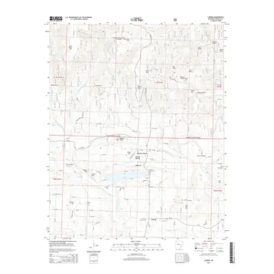
2014 Map of Ludwig
USGS Topo · Published 2014About this map
Lake Ludwig serves as a central hub for the small communities and rural networks of Johnson County, Arkansas. This landscape is defined by the sharp transition from the southern extent of the Ozark National Forest to the industrialized terrain of the Clarksville Gas Field and Ludwig Gas Field. Small settlements like Hillcrest and Ludwig are connected by a web of local routes including State Hwy 21 and various county roads. Family history is well-preserved across the quadrangle, with multiple burial sites such as Mt Airy Memorial Cem, Johnson Cem, and the Old King Cem near the banks of Spadra Creek. High elevations like Mac Wood Mtn and Katie Knob look down upon numerous hollows and bluffs, including Feltner Bluff, reflecting the intricate topography of the Arkansas Ozarks during the early 21st century.
Find a feature on this map
110 named features on this map. Tap any name to fly to it.
Don’t see what you’re looking for? This feature index may not catch every label — zoom into the map to look around manually.
Map Details
Editions of this 2014 Ludwig Map
This is the sole edition of this map. No revisions or reprints were ever made.
Other maps of this area

1887 · Magazine Mountain #1
USGS Topo · 1:62,500

1887 · Magazine Mountain
USGS Topo · 1:62,500

1888 · Dardanelle #2
USGS Topo · 1:62,500

1889 · Ozone
USGS Topo · 1:62,500

1890 · Magazine Mountain
USGS Topo · 1:125,000

1890 · Dardanelle
USGS Topo · 1:125,000

1906 · Batson
USGS Topo · 1:62,500

1934 · Ozone
USGS Topo · 1:62,500

1936 · Ozone
USGS Topo · 1:62,500

1956 · Russellville
USGS Topo · 1:250,000