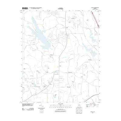
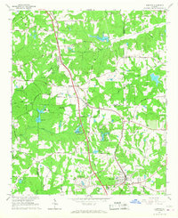
2011 Map of Luella
USGS Topo · Published 2011About this map
Luella serves as a central hub in this landscape of the early 21st century, where the headwaters of the Tomaliga River and numerous tributaries like Troublesome Creek and Cabin Creek have been harnessed for local water management. The area is heavily defined by small-scale impoundments, with dozens of named dams such as the Dundee Lake Dam and Regents Lake Dam creating local reservoirs. Genealogists will find significant value in the distribution of family-named burial sites, including the Pullin Cemetery, Barham Cemetery, and Bostick Cemetery, which are scattered among the evolving suburban and industrial corridors. Historic settlement patterns remain visible through place names like Steeles Mill and Walker Mill, while more modern land uses are represented by Mallards Landing Airport and the Cabin Creek Golf Course, illustrating the region's transition from a strictly agrarian past to a multifaceted residential and light industrial community.
Find a feature on this map
106 named features on this map. Tap any name to fly to it.
Don’t see what you’re looking for? This feature index may not catch every label — zoom into the map to look around manually.
Map Details
Editions of this 2011 Luella Map
This is the sole edition of this map. No revisions or reprints were ever made.
Other maps of this area

1951 · Barnesville
USGS Topo · 1:62,500

1953 · Atlanta
USGS Topo · 1:250,000

1957 · Atlanta
USGS Topo · 1:250,000

1958 · Atlanta
USGS Topo · 1:250,000

1964 · Luella
USGS Topo · 1:24,000
1964 · Mc Donough
USGS Topo · 1:24,000
1964 · Ola
USGS Topo · 1:24,000
1964 · Locust Grove
USGS Topo · 1:24,000
1965 · Hampton
USGS Topo · 1:24,000

1965 · Griffin North
USGS Topo · 1:24,000