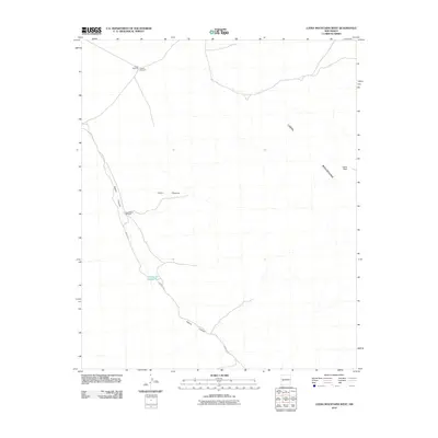
2010 Map of Luera Mountains West
USGS Topo · Published 2010About this map
Luera Peak stands as the primary landmark in the high desert of Catron County, anchoring the eastern edge of the Luera Mountains. This terrain is defined by dry watercourses and seasonal drainages, most notably the long stretch of Alamo Canyon and its tributary Obaro Cyn. The land use is centered on ranching infrastructure necessary for survival in this arid environment, evidenced by isolated water points like Elosia Windmill and the Hay Pasture Windmill. The presence of the Above Hay Pasture Tank further illustrates the management of water in the high-elevation basin near Cañon Obscura. This survey provides a specialized look at the rural topography of the New Mexico interior, where the network of primitive roads connects essential windmills across a sparsely populated landscape.
Find a feature on this map
8 named features on this map. Tap any name to fly to it.
Don’t see what you’re looking for? This feature index may not catch every label — zoom into the map to look around manually.
Map Details
Editions of this 2010 Luera Mountains West Map
This is the sole edition of this map. No revisions or reprints were ever made.
Other maps of this area

1918 · Pelona
USGS Topo · 1:125,000

1954 · Tularosa
USGS Topo · 1:250,000

1954 · Clifton
USGS Topo · 1:250,000

1957 · Clifton
USGS Topo · 1:250,000

1958 · Clifton
USGS Topo · 1:250,000

1958 · Tularosa
USGS Topo · 1:250,000

1962 · Clifton
USGS Topo · 1:250,000

1979 · San Mateo Mountains
USGS Topo · 1:100,000
1981 · Luera Mountains NW
USGS Topo · 1:24,000
1981 · Pelona Mountain
USGS Topo · 1:24,000