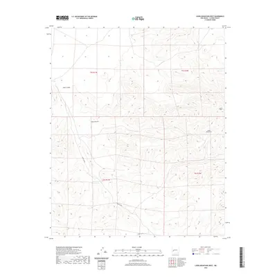
2020 Map of Luera Mountains West
USGS Topo · Published 2020About this map
Luera Peak rises as the dominant landmark in this southwestern corner of the San Agustin Plains region, anchoring the northern reaches of the Luera Mountains. The terrain is defined by a series of deep drainage systems, including the westward-reaching Alamo Canyon and the winding Obaro Canyon, which carve through the high-elevation landscape. Human presence in this section of Catron County is sparse, marked primarily by ranching infrastructure and forest management routes. The map identifies Above-Hay Pasture Tank as a vital water source for livestock in this arid environment, while Forest Rd 30 provides the primary vehicular access through the southern portion of the quadrangle. Other notable topographical features include the steep walls of Cañon Obscura, illustrating the complex geological erosion patterns characteristic of this part of New Mexico.
Find a feature on this map
11 named features on this map. Tap any name to fly to it.
Don’t see what you’re looking for? This feature index may not catch every label — zoom into the map to look around manually.
Map Details
Editions of this 2020 Luera Mountains West Map
This is the sole edition of this map. No revisions or reprints were ever made.
Other maps of this area
1918 · Pelona
USGS Topo · 1:125,000

1954 · Tularosa
USGS Topo · 1:250,000

1954 · Clifton
USGS Topo · 1:250,000

1957 · Clifton
USGS Topo · 1:250,000

1958 · Clifton
USGS Topo · 1:250,000

1958 · Tularosa
USGS Topo · 1:250,000
1962 · Clifton
USGS Topo · 1:250,000
1979 · San Mateo Mountains
USGS Topo · 1:100,000
1981 · Luera Mountains NW
USGS Topo · 1:24,000
1981 · Pelona Mountain
USGS Topo · 1:24,000