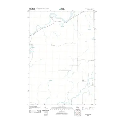
2010 Map of Lugerville
USGS Topo · Published 2010About this map
Lugerville sits at the eastern edge of this Price County landscape, where the South Fork Flambeau River meets the smaller tributaries of Mount Pelee Creek and Spring Creek. The geography is defined by a dense network of water, including the main channel of the Flambeau River in the north and numerous named glacial basins like Betsy Lake, Peters Lake, and LeClaire Lake. This 2010 survey illustrates a region shaped by timber and water management, evidenced by the Crowley WP381 Dam on the upper river and the Lugerville Lookout Tower positioned near the settlement. Roads such as Swamp Rd and Popple Hill Rd navigate the low-lying terrain between the creeks, while County Hwy F provides the primary corridor through the area's woodlands and marshes.
Find a feature on this map
36 named features on this map. Tap any name to fly to it.
Don’t see what you’re looking for? This feature index may not catch every label — zoom into the map to look around manually.
Map Details
Editions of this 2010 Lugerville Map
This is the sole edition of this map. No revisions or reprints were ever made.
Other maps of this area

1941 · Park Falls
USGS Topo · 1:48,000

1941 · Kennan
USGS Topo · 1:48,000

1941 · Kennedy
USGS Topo · 1:48,000

1941 · Phillips
USGS Topo · 1:48,000

1943 · Park Falls
USGS Topo · 1:48,000

1943 · Philliips
USGS Topo · 1:48,000

1945 · Kennedy
USGS Topo · 1:48,000

1945 · Kennan
USGS Topo · 1:48,000

1947 · Park Falls
USGS Topo · 1:48,000

1953 · Rice Lake
USGS Topo · 1:250,000