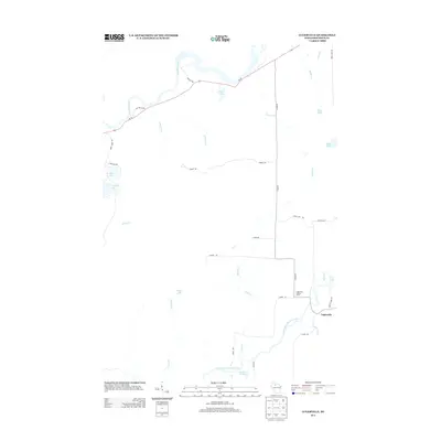
2013 Map of Lugerville
USGS Topo · Published 2013About this map
Lugerville sits at the confluence of the South Fork Flambeau River and Mount Pelee Cr, serving as a focal point for this Price County landscape. The topography is defined by its extensive water network, including the main channel of the Flambeau River and numerous tributaries such as Sixmile Cr, Ninemile Cr, and Maiden Cr. The area is dotted with glacial lakes like Betsy Lake, LeClaire Lake, and Peters Lake, indicating a terrain shaped by heavy woodland and wetlands, reinforced by labels like Swamp Rd. Notable landmarks like the Lugerville Lookout Tower and Rocky Carry Rapids provide specific points of interest for those tracking local heritage or geographical changes. The road network, including Wi-70 and Co Hwy-F, connects the small settlement of Lugerville to the broader region during this early 21st-century period.
Find a feature on this map
38 named features on this map. Tap any name to fly to it.
Don’t see what you’re looking for? This feature index may not catch every label — zoom into the map to look around manually.
Map Details
Editions of this 2013 Lugerville Map
This is the sole edition of this map. No revisions or reprints were ever made.
Other maps of this area

1941 · Park Falls
USGS Topo · 1:48,000

1941 · Kennan
USGS Topo · 1:48,000

1941 · Kennedy
USGS Topo · 1:48,000

1941 · Phillips
USGS Topo · 1:48,000

1943 · Park Falls
USGS Topo · 1:48,000

1943 · Philliips
USGS Topo · 1:48,000

1945 · Kennedy
USGS Topo · 1:48,000

1945 · Kennan
USGS Topo · 1:48,000

1947 · Park Falls
USGS Topo · 1:48,000

1953 · Rice Lake
USGS Topo · 1:250,000