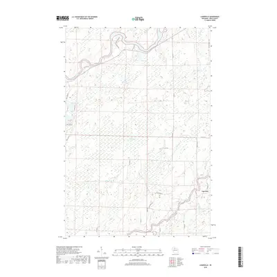
2018 Map of Lugerville
USGS Topo · Published 2018About this map
Lugerville sits near the southeastern corner of this map, serving as a focal point for a landscape defined by its intricate water systems and extensive wetlands. The South Fork Flambeau River winds through the southern terrain, where the turbulent Rocky Carry Rapids and Niebauer Springs indicate a dynamic riparian environment. To the north, the main branch of the Flambeau River carves through the land, flanked by numerous smaller tributaries like Sixmile Cr and Pixley Cr. The center of the quadrangle is dominated by the Million Acre Swamp, a vast lowland area that underscores the region's wilderness character and limits industrial expansion.
Find a feature on this map
40 named features on this map. Tap any name to fly to it.
Don’t see what you’re looking for? This feature index may not catch every label — zoom into the map to look around manually.
Map Details
Editions of this 2018 Lugerville Map
This is the sole edition of this map. No revisions or reprints were ever made.
Other maps of this area

1941 · Park Falls
USGS Topo · 1:48,000

1941 · Kennan
USGS Topo · 1:48,000

1941 · Kennedy
USGS Topo · 1:48,000

1941 · Phillips
USGS Topo · 1:48,000

1943 · Park Falls
USGS Topo · 1:48,000

1943 · Philliips
USGS Topo · 1:48,000

1945 · Kennedy
USGS Topo · 1:48,000

1945 · Kennan
USGS Topo · 1:48,000

1947 · Park Falls
USGS Topo · 1:48,000

1953 · Rice Lake
USGS Topo · 1:250,000