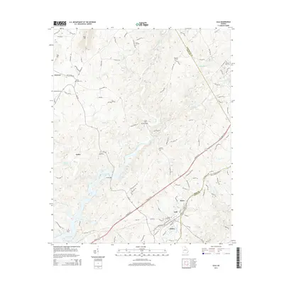
2014 Map of Lula
USGS Topo · Published 2014About this map
Lula and Belton sit at a convergence of topography and transport in northeast Georgia, where the Southern railroad tracks parallel the Hall Co Banks Co line. This landscape is defined by the winding course of the Chattahoochee River, which serves as a natural boundary between counties. The area exhibits a pattern of upland ridges like Skitt Mtn and Hog Mtn transitioning into the broader waters of Lake Sidney Lanier to the southwest. Local history is anchored by numerous rural burial grounds, including Clemons Chapel Cem and Skitts Mtn Cem, marking early community centers. The map preserves several river crossing points, notably the Crowder Ford and Bellton Bridge, which historically connected the dispersed settlements of Glades and Clermont to the rail hubs. The drainage network of Hagen Cr and Mud Cr provides a detailed look at the hydrology feeding into the regional river systems.
Find a feature on this map
114 named features on this map. Tap any name to fly to it.
Don’t see what you’re looking for? This feature index may not catch every label — zoom into the map to look around manually.
Map Details
Editions of this 2014 Lula Map
This is the sole edition of this map. No revisions or reprints were ever made.
Other maps of this area

1886 · Dahlonega
USGS Topo · 1:125,000

1891 · Gainesville
USGS Topo · 1:125,000

1892 · Dahlonega
USGS Topo · 1:125,000

1896 · Dahlonega
USGS Topo · 1:125,000

1903 · Dahlonega
USGS Topo · 1:125,000

1951 · Cleveland
USGS Topo · 1:24,000

1954 · Greenville
USGS Topo · 1:250,000

1958 · Greenville
USGS Topo · 1:250,000

1964 · Maysville
USGS Topo · 1:24,000

1964 · Lula
USGS Topo · 1:24,000