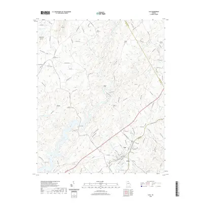
2020 Map of Lula
USGS Topo · Published 2020About this map
Lula and its neighbor Bellton sit at the crossroads of northern Georgia’s rolling foothills, where the boundaries of Hall, Banks, and Habersham counties converge. This modern topographic study reveals a landscape defined by the upper reaches of the Chattahoochee River and the Oconee River, punctuated by prominent elevations such as Skitt Mtn and Hog Mtn. The dense network of cemeteries, including Hulsey Cem and Skitts Mountain Cem, provides a detailed record of the families who settled this region between the river valleys.
Find a feature on this map
126 named features on this map. Tap any name to fly to it.
Don’t see what you’re looking for? This feature index may not catch every label — zoom into the map to look around manually.
Map Details
Editions of this 2020 Lula Map
This is the sole edition of this map. No revisions or reprints were ever made.
Other maps of this area

1886 · Dahlonega
USGS Topo · 1:125,000

1891 · Gainesville
USGS Topo · 1:125,000

1892 · Dahlonega
USGS Topo · 1:125,000

1896 · Dahlonega
USGS Topo · 1:125,000

1903 · Dahlonega
USGS Topo · 1:125,000

1951 · Cleveland
USGS Topo · 1:24,000

1954 · Greenville
USGS Topo · 1:250,000

1958 · Greenville
USGS Topo · 1:250,000

1964 · Maysville
USGS Topo · 1:24,000

1964 · Lula
USGS Topo · 1:24,000