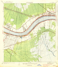
1938 Map of Luling
USGS Topo · Published 1938About this map
The Mississippi River dominates this mid-1930s landscape, flanked by a dense network of river-town settlements and intricate drainage systems. On the west bank, communities like Luling and Lone Star are situated on the natural levee, while the east bank features Destrehan, St Rose, and the edge of Kenner. This period captures the region's transition into a modern transport corridor, showing the newly established Airline Highway and three major rail lines—the Illinois Central Railroad, Texas and Pacific Railroad, and Southern Pacific Railroad—parallel to the river.
Find a feature on this map
40 named features on this map. Tap any name to fly to it.
Don’t see what you’re looking for? This feature index may not catch every label — zoom into the map to look around manually.
Map Details
Editions of this 1938 Luling Map
3 editions found
Other maps of this area

1891 · Hahnville
USGS Topo · 1:62,500

1891 · Spanish Fort
USGS Topo · 1:62,500

1891 · New Orleans
USGS Topo · 1:62,500

1892 · Bonnet Carre
USGS Topo · 1:62,500

1932 · New Orleans NW
USGS Topo · 1:31,680

1932 · New Orleans SW
USGS Topo · 1:31,680

1932 · Hahnville NW
USGS Topo · 1:31,680

1932 · Hahnville SW
USGS Topo · 1:31,680

1932 · Hahnville NE
USGS Topo · 1:31,680

1935 · Laplace
USGS Topo · 1:31,680