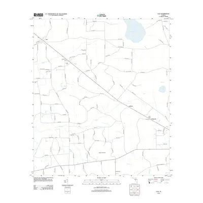
2012 Map of Lulu
USGS Topo · Published 2012About this map
Olustee Cr and Swift Cr define the hydrologic character of this Union County landscape, winding through a patchwork of agricultural lands and wooded hammocks. The small settlements of Lulu, Guilford, and Cliftonville are linked by a grid of rural roads and the diagonal corridor of Co HWY-231. For family historians, the presence of Gillen Allen Cem, Douglas Cem, and New Zion Cem provides essential points of reference for tracing local heritage near the Columbia County line.
Find a feature on this map
100 named features on this map. Tap any name to fly to it.
Don’t see what you’re looking for? This feature index may not catch every label — zoom into the map to look around manually.
Map Details
Editions of this 2012 Lulu Map
This is the sole edition of this map. No revisions or reprints were ever made.
Other maps of this area

1954 · Gainesville
USGS Topo · 1:250,000

1954 · Valdosta
USGS Topo · 1:250,000

1958 · Valdosta
USGS Topo · 1:250,000

1958 · Gainesville
USGS Topo · 1:250,000

1959 · Valdosta
USGS Topo · 1:250,000

1959 · Gainesville
USGS Topo · 1:250,000

1962 · Lake City East
USGS Topo · 1:24,000

1962 · Mikesville
USGS Topo · 1:24,000

1963 · Olustee
USGS Topo · 1:24,000

1963 · Sanderson South
USGS Topo · 1:24,000