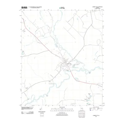
2011 Map of Lumber City
USGS Topo · Published 2011About this map
Lumber City serves as the focal point of this riverine landscape, situated where the Little Ocmulgee River meets the larger Ocmulgee River. The town's historical reliance on these waterways is evidenced by several river access points, including the Lumber City Landing, Murdock McRaes Landing, and the curiously named Hard Bargain Landing. To the south, the settlement of Walkers Camp sits near a bend in the river, while the local infrastructure is further defined by the Hazlehurst Airport and several water management features like Cook Lake and its associated Cook Lake Dam. Family history and local heritage are well-preserved across the quadrangle at sites such as Riverside Cemetery, Wooten Cemetery, and McArthur Cemetery. The geography is characterized by a network of creeks, including Alligator Creek and Sugar Creek, which drain into the main river systems through a series of wetlands and small lakes like Sears Lake and Powell Lake.
Find a feature on this map
49 named features on this map. Tap any name to fly to it.
Don’t see what you’re looking for? This feature index may not catch every label — zoom into the map to look around manually.
Map Details
Editions of this 2011 Lumber City Map
This is the sole edition of this map. No revisions or reprints were ever made.
Other maps of this area

1953 · Waycross
USGS Topo · 1:250,000

1957 · Macon
USGS Topo · 1:250,000

1958 · Macon
USGS Topo · 1:250,000

1958 · Waycross
USGS Topo · 1:250,000

1964 · Macon
USGS Topo · 1:250,000

1970 · Scotland
USGS Topo · 1:24,000

1970 · Uvalda
USGS Topo · 1:24,000

1970 · Jordan
USGS Topo · 1:24,000

1971 · Roper
USGS Topo · 1:24,000

1971 · Jacksonville NE
USGS Topo · 1:24,000