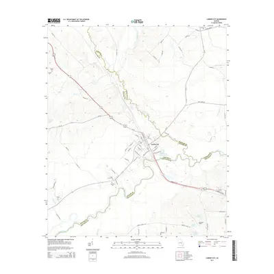
2014 Map of Lumber City
USGS Topo · Published 2014About this map
Lumber City sits at the strategic confluence of three Georgia counties, where the Little Ocmulgee River joins the larger Ocmulgee River. This map reveals a landscape defined by its waterways and transit corridors, including the path of Burketts Ferry Rd and numerous river-adjacent landmarks like Lovers Leap RD. The town's grid is dense with industrial and residential labels, featuring Industrial Blvd, E Railroad St, and Central Ave, reflecting its history as a processing hub for the surrounding timberlands.
Find a feature on this map
74 named features on this map. Tap any name to fly to it.
Don’t see what you’re looking for? This feature index may not catch every label — zoom into the map to look around manually.
Map Details
Editions of this 2014 Lumber City Map
This is the sole edition of this map. No revisions or reprints were ever made.
Other maps of this area

1953 · Waycross
USGS Topo · 1:250,000

1957 · Macon
USGS Topo · 1:250,000

1958 · Macon
USGS Topo · 1:250,000

1958 · Waycross
USGS Topo · 1:250,000

1964 · Macon
USGS Topo · 1:250,000

1970 · Scotland
USGS Topo · 1:24,000

1970 · Uvalda
USGS Topo · 1:24,000

1970 · Jordan
USGS Topo · 1:24,000

1971 · Roper
USGS Topo · 1:24,000

1971 · Jacksonville NE
USGS Topo · 1:24,000