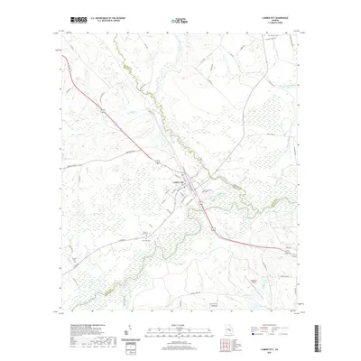
2020 Map of Lumber City
USGS Topo · Published 2020About this map
Lumber City sits at the convergence of the Little Ocmulgee River and the main channel of the Ocmulgee River, serving as a central point where Telfair, Wheeler, and Jeff Davis counties meet. The town grid is clearly defined by streets such as Main St, Ocmulgee St, and West Ave, illustrating the town's historical orientation toward the riverbanks and the rail corridor. The surrounding landscape is heavily defined by wetlands and creek drainages, including Alligator Creek and Tillman Mill Creek.
Find a feature on this map
72 named features on this map. Tap any name to fly to it.
Don’t see what you’re looking for? This feature index may not catch every label — zoom into the map to look around manually.
Map Details
Editions of this 2020 Lumber City Map
This is the sole edition of this map. No revisions or reprints were ever made.
Other maps of this area

1953 · Waycross
USGS Topo · 1:250,000

1957 · Macon
USGS Topo · 1:250,000

1958 · Macon
USGS Topo · 1:250,000

1958 · Waycross
USGS Topo · 1:250,000

1964 · Macon
USGS Topo · 1:250,000

1970 · Scotland
USGS Topo · 1:24,000

1970 · Uvalda
USGS Topo · 1:24,000

1970 · Jordan
USGS Topo · 1:24,000

1971 · Roper
USGS Topo · 1:24,000

1971 · Jacksonville NE
USGS Topo · 1:24,000