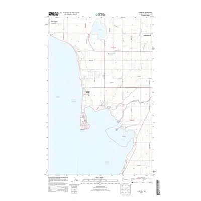
2014 Map of Lummi Bay
USGS Topo · Published 2014About this map
Lake Terrell dominates the northern interior of this coastal Washington landscape, where the freshwater basin is surrounded by a dense grid of rural roads including Lake Terrell Rd and Mountain View Rd. Along the shoreline of the Strait of Georgia, industrial and residential patterns converge near Cherry Point and the Intalco facility. To the south, the geography shifts toward the tidal environment of Lummi Bay, marked by the distinct Lummi Bay Sea Ponds and the sprawling Lummi Flats. Residential developments like Neptune Beach and Sandy Point Shores occupy the narrow peninsula leading to the prominent hook of Sandy Point. The map also identifies the significant cultural site of Cha-Choo-Sen, situated near the mouth of the Lummi River, illustrating the intersection of natural drainage and long-standing coastal habitation.
Find a feature on this map
60 named features on this map. Tap any name to fly to it.
Don’t see what you’re looking for? This feature index may not catch every label — zoom into the map to look around manually.
Map Details
Editions of this 2014 Lummi Bay Map
This is the sole edition of this map. No revisions or reprints were ever made.
Other maps of this area

1907 · Blaine
USGS Topo · 1:62,500

1943 · Orcas Island
USGS Topo · 1:62,500

1943 · Anacortes
USGS Topo · 1:62,500

1951 · Anacortes
USGS Topo · 1:62,500

1952 · Bertrand Creek
USGS Topo · 1:24,000

1952 · Birch Point
USGS Topo · 1:24,000

1952 · Ferndale
USGS Topo · 1:24,000

1952 · Lummi Bay
USGS Topo · 1:24,000

1952 · Blaine
USGS Topo · 1:24,000

1952 · Blaine
USGS Topo · 1:62,500