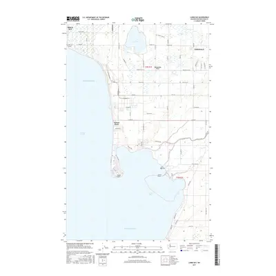
2017 Map of Lummi Bay
USGS Topo · Published 2017About this map
Lake Terrell and its surrounding wetlands dominate the inland landscape of this coastal survey, where the terrestrial environment meets the waters of the Puget Sound and the Strait of Georgia. The map records the interface of industrial and residential development along the shorelines of Whatcom County, stretching from the community of Ferndale in the east to Neptune Beach and the prominent protrusion of Sandy Point in the west. Heavy infrastructure is evident through the Intalco rail line and the specialized waterfront at Cherry Point.
Find a feature on this map
56 named features on this map. Tap any name to fly to it.
Don’t see what you’re looking for? This feature index may not catch every label — zoom into the map to look around manually.
Map Details
Editions of this 2017 Lummi Bay Map
This is the sole edition of this map. No revisions or reprints were ever made.
Other maps of this area

1907 · Blaine
USGS Topo · 1:62,500

1943 · Orcas Island
USGS Topo · 1:62,500

1943 · Anacortes
USGS Topo · 1:62,500

1951 · Anacortes
USGS Topo · 1:62,500

1952 · Bertrand Creek
USGS Topo · 1:24,000

1952 · Birch Point
USGS Topo · 1:24,000

1952 · Ferndale
USGS Topo · 1:24,000

1952 · Lummi Bay
USGS Topo · 1:24,000

1952 · Blaine
USGS Topo · 1:24,000

1952 · Blaine
USGS Topo · 1:62,500