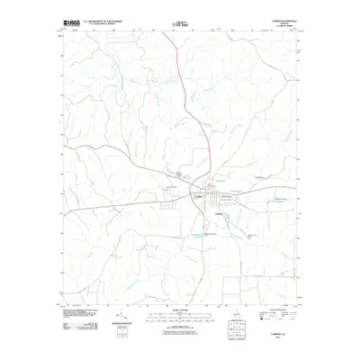
2011 Map of Lumpkin
USGS Topo · Published 2011About this map
Lumpkin serves as the focal point of this Stewart County landscape, where the confluence of local roads and water management features defines the community's structure. The topography is marked by a series of engineered water bodies and dams, including Ushers Millpond Dam and Holders Pond Dam, which punctuate the courses of Hodchodkee Creek and its various branches. These millponds and ponds suggest a history of local water utilization and drainage management in this part of Georgia.
Find a feature on this map
48 named features on this map. Tap any name to fly to it.
Don’t see what you’re looking for? This feature index may not catch every label — zoom into the map to look around manually.
Map Details
Editions of this 2011 Lumpkin Map
This is the sole edition of this map. No revisions or reprints were ever made.
Other maps of this area

1949 · Julia
USGS Topo · 1:24,000

1950 · Louvale
USGS Topo · 1:24,000

1950 · Lumpkin
USGS Topo · 1:24,000

1950 · Lumpkin SW
USGS Topo · 1:24,000

1950 · Lumpkin
USGS Topo · 1:62,500

1953 · Dothan
USGS Topo · 1:250,000

1954 · Dothan
USGS Topo · 1:250,000

1955 · Dothan
USGS Topo · 1:250,000

1955 · Lumpkin
USGS Topo · 1:24,000
1955 · Louvale
USGS Topo · 1:24,000