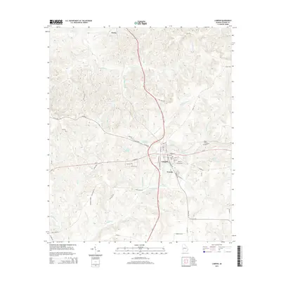
2014 Map of Lumpkin
USGS Topo · Published 2014About this map
Lumpkin serves as the central hub of this Georgia landscape, positioned at the intersection of several significant local routes including W Broad St and Main St. The town is flanked by historic sites such as N Side Cem, E Side Cem, and the Ebenezer Cem, providing valuable geographic context for local genealogy and history. To the south lies Westville, situated near the waters of Hodchodkee Cr. The surrounding terrain is defined by a network of creeks and small drainages like Frog Bottom Cr and Wimberly Mill Br, which feed into local landmarks such as Ushers Millpond and Forts Pond. The presence of Peek Hollow and various pond features suggests a landscape shaped by agricultural needs and natural water management, while the northern settlement of Charles marks a smaller node in this rural network.
Find a feature on this map
55 named features on this map. Tap any name to fly to it.
Don’t see what you’re looking for? This feature index may not catch every label — zoom into the map to look around manually.
Map Details
Editions of this 2014 Lumpkin Map
This is the sole edition of this map. No revisions or reprints were ever made.
Other maps of this area

1949 · Julia
USGS Topo · 1:24,000

1950 · Louvale
USGS Topo · 1:24,000

1950 · Lumpkin
USGS Topo · 1:24,000

1950 · Lumpkin SW
USGS Topo · 1:24,000

1950 · Lumpkin
USGS Topo · 1:62,500

1953 · Dothan
USGS Topo · 1:250,000

1954 · Dothan
USGS Topo · 1:250,000

1955 · Dothan
USGS Topo · 1:250,000

1955 · Lumpkin
USGS Topo · 1:24,000
1955 · Louvale
USGS Topo · 1:24,000