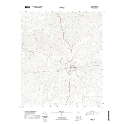
2020 Map of Lumpkin
USGS Topo · Published 2020About this map
The Stewart County Courthouse serves as the central landmark for the town of Lumpkin, anchoring a street grid that includes Cherry St, Broad St, and Main St. This survey of southwestern Georgia reveals a landscape defined by an intricate network of waterways and millponds, reflecting the region's agricultural and milling heritage. Ushers Millpond and Forts Pond sit just west of the town center, while names like Wimberly Mill Br suggest the historical locations of early local industry.
Find a feature on this map
61 named features on this map. Tap any name to fly to it.
Don’t see what you’re looking for? This feature index may not catch every label — zoom into the map to look around manually.
Map Details
Editions of this 2020 Lumpkin Map
This is the sole edition of this map. No revisions or reprints were ever made.
Other maps of this area

1949 · Julia
USGS Topo · 1:24,000

1950 · Louvale
USGS Topo · 1:24,000

1950 · Lumpkin
USGS Topo · 1:24,000

1950 · Lumpkin SW
USGS Topo · 1:24,000

1950 · Lumpkin
USGS Topo · 1:62,500

1953 · Dothan
USGS Topo · 1:250,000

1954 · Dothan
USGS Topo · 1:250,000

1955 · Dothan
USGS Topo · 1:250,000

1955 · Lumpkin
USGS Topo · 1:24,000
1955 · Louvale
USGS Topo · 1:24,000