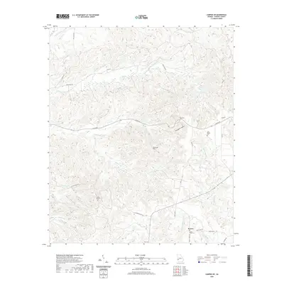
2020 Map of Lumpkin SW
USGS Topo · Published 2020About this map
Patterson Hills dominate the central landscape of this Stewart County region, characterized by a complex network of deep drainages and ridges. The topography is defined by the striking Providence Canyons, a notable geological feature often referred to as Georgia's Little Grand Canyon. The settlement of Beatrice sits in the southeast, serving as a focal point for local transportation routes like Green Grove Rd and Wesley Chapel Rd.
Find a feature on this map
33 named features on this map. Tap any name to fly to it.
Don’t see what you’re looking for? This feature index may not catch every label — zoom into the map to look around manually.
Map Details
Editions of this 2020 Lumpkin SW Map
This is the sole edition of this map. No revisions or reprints were ever made.
Other maps of this area

1949 · Julia
USGS Topo · 1:24,000

1950 · Louvale
USGS Topo · 1:24,000

1950 · Lumpkin
USGS Topo · 1:24,000

1950 · Lumpkin SW
USGS Topo · 1:24,000

1950 · Lumpkin
USGS Topo · 1:62,500

1953 · Dothan
USGS Topo · 1:250,000

1954 · Dothan
USGS Topo · 1:250,000

1955 · Dothan
USGS Topo · 1:250,000

1955 · Lumpkin
USGS Topo · 1:24,000
1955 · Louvale
USGS Topo · 1:24,000