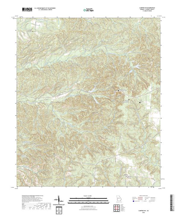
2024 Map of Lumpkin SW
USGS Topo · Published 2024About this map
Beatrice sits at the heart of this rural landscape in Stewart County, where a network of family-linked cemeteries and country churches defines the social geography. The terrain is notably dissected by intricate water systems including Talipahoga Rum Creek and Soapstone Creek, leading toward the dramatic geography of the Providence Canyons. These features illustrate the erosion-prone soil and complex drainage patterns that have shaped land use and local history in southwestern Georgia.
Find a feature on this map
36 named features on this map. Tap any name to fly to it.
Don’t see what you’re looking for? This feature index may not catch every label — zoom into the map to look around manually.
Map Details
Editions of this 2024 Lumpkin SW Map
This is the sole edition of this map. No revisions or reprints were ever made.
Other maps of this area

1949 · Julia
USGS Topo · 1:24,000

1950 · Louvale
USGS Topo · 1:24,000

1950 · Lumpkin
USGS Topo · 1:24,000

1950 · Lumpkin SW
USGS Topo · 1:24,000

1950 · Lumpkin
USGS Topo · 1:62,500

1953 · Dothan
USGS Topo · 1:250,000

1954 · Dothan
USGS Topo · 1:250,000

1955 · Dothan
USGS Topo · 1:250,000

1955 · Lumpkin
USGS Topo · 1:24,000
1955 · Louvale
USGS Topo · 1:24,000