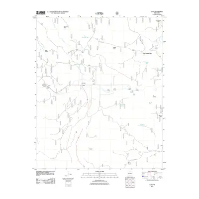
2011 Map of Luna
USGS Topo · Published 2011About this map
Luna serves as the primary settlement hub in this high-altitude landscape where the San Francisco River meets the canyon-carved terrain of Catron County. The map documents a land shaped by both hydrology and range life, featuring numerous water tanks like Dillman Tank and Kiehne Tank that support the ranching operations evidenced by Laney Corral and the Old Campbell Place. National Forest infrastructure is prominent, centered around the Luna District Ranger Office and the Head of the Ditch Campground, while forestry roads such as Forest Rd 210 and Forestry Road 35 provide access to the timbered reaches near Potato Patch. The presence of family-named landmarks like the Ruyle Place and distinctive landforms such as Hellroaring Mesa reflect the deep-rooted settlement history of this mountain valley community.
Find a feature on this map
43 named features on this map. Tap any name to fly to it.
Don’t see what you’re looking for? This feature index may not catch every label — zoom into the map to look around manually.
Map Details
Editions of this 2011 Luna Map
This is the sole edition of this map. No revisions or reprints were ever made.
Other maps of this area

1915 · Reserve
USGS Topo · 1:125,000

1918 · Reserve
USGS Topo · 1:125,000

1922 · Nutrioso
USGS Topo · 1:125,000

1954 · Clifton
USGS Topo · 1:250,000

1957 · Clifton
USGS Topo · 1:250,000

1958 · Clifton
USGS Topo · 1:250,000

1958 · Alpine
USGS Topo · 1:62,500

1961 · Blue
USGS Topo · 1:62,500

1962 · Clifton
USGS Topo · 1:250,000
1965 · Reserve
USGS Topo · 1:24,000