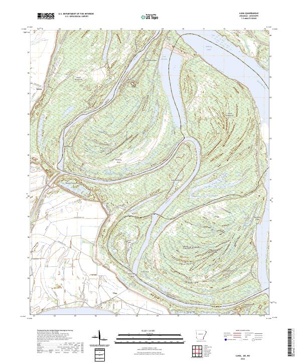
2024 Map of Luna
USGS Topo · Published 2024About this map
The Old River and the Mississippi River dominate this landscape on the border of Arkansas and Mississippi, where the shifting riverbed has created a complex network of cutoffs and islands. The settlement of Luna sits near the southern edge of the sheet, adjacent to the wide Luna Bar and Spanish Moss Bend. This area of Chicot County is defined by the historical remnants of river migration, such as the Ashbrook Cutoff and several named necks of land including Ashbrook Neck and Linwood Neck.
Find a feature on this map
54 named features on this map. Tap any name to fly to it.
Don’t see what you’re looking for? This feature index may not catch every label — zoom into the map to look around manually.
Map Details
Editions of this 2024 Luna Map
This is the sole edition of this map. No revisions or reprints were ever made.
Other maps of this area

1933 · Lamont
USGS Topo · 1:62,500

1936 · McGehee
USGS Topo · 1:62,500

1936 · Lake Village
USGS Topo · 1:62,500

1937 · McGehee
USGS Topo · 1:62,500

1939 · Refuge
USGS Topo · 1:62,500

1939 · Lamont
USGS Topo · 1:62,500

1953 · Greenwood
USGS Topo · 1:250,000

1955 · Lake Village
USGS Topo · 1:62,500

1955 · McGehee
USGS Topo · 1:62,500

1956 · Greenwood
USGS Topo · 1:250,000