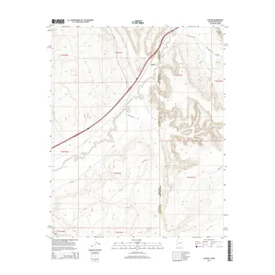
2014 Map of Lupton
USGS Topo · Published 2014About this map
Lupton sits at a critical geographic and administrative juncture, where the high desert terrain of the Apache and McKinley County line meets the Arizona-New Mexico border. This survey documents the modern transportation corridor that follows the historic path of the Puerco River, including various state and Bureau of Indian Affairs routes like Az-118 and NM-118. The landscape is defined by the contrast between the flat river valley and the dramatic relief of Wild Goat Canyon to the northeast.
Find a feature on this map
38 named features on this map. Tap any name to fly to it.
Don’t see what you’re looking for? This feature index may not catch every label — zoom into the map to look around manually.
Map Details
Editions of this 2014 Lupton Map
This is the sole edition of this map. No revisions or reprints were ever made.
Other maps of this area

1886 · Wingate
USGS Topo · 1:250,000

1886 · Fort Defiance
USGS Topo · 1:250,000

1892 · Fort Defiance
USGS Topo · 1:250,000

1892 · Wingate
USGS Topo · 1:250,000

1954 · Gallup
USGS Topo · 1:250,000

1958 · Gallup
USGS Topo · 1:250,000

1959 · Gallup
USGS Topo · 1:250,000

1962 · Gallup
USGS Topo · 1:250,000

1963 · Manuelito
USGS Topo · 1:24,000

1963 · Jones Ranch School
USGS Topo · 1:24,000
Featured Places
- Fort Defiance Agency
- Eastern Navajo Agency, NM
- Lupton, Fort Defiance Agency
- McKinley County, NM
- Apache County, AZ