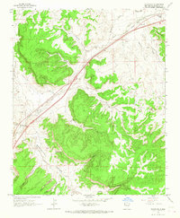
1963 Map of Manuelito
USGS Topo · Published 1967About this map
Manuelito serves as a central point in this high-desert landscape, where the Atchison Topeka and Santa Fe railroad and a main 2 Lane road parallel the course of the Puerco River. This corridor represents a vital transportation artery through McKinley County, evidenced by the presence of a Port of Entry and the proximity of small settlements like Defiance and Williams Acres. The map reveals a deeply eroded topography defined by named drainages such as Manuelito Canyon, Big Rock Canyon, and Squash Canyon. High features like Torrivio Mesa and Purty Rock overlook the valleys, while localized water sources such as Sand Spring and various wells indicate the sparse but essential water network required for habitation in this arid environment during the early 1960s.
Find a feature on this map
28 named features on this map. Tap any name to fly to it.
Don’t see what you’re looking for? This feature index may not catch every label — zoom into the map to look around manually.
Map Details
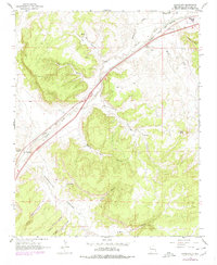
Editions of this 1963 Manuelito Map
2 editions found
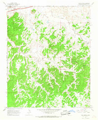
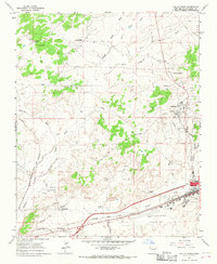
Other maps of this area

1886 · Wingate
USGS Topo · 1:250,000

1886 · Fort Defiance
USGS Topo · 1:250,000

1892 · Fort Defiance
USGS Topo · 1:250,000

1892 · Wingate
USGS Topo · 1:250,000

1954 · Gallup
USGS Topo · 1:250,000

1958 · Gallup
USGS Topo · 1:250,000

1959 · Gallup
USGS Topo · 1:250,000

1962 · Gallup
USGS Topo · 1:250,000
1963 · Twin Buttes
USGS Topo · 1:24,000
1963 · Gallup West
USGS Topo · 1:24,000
Featured Places
- Eastern Navajo Agency, NM
- Manuelito, Eastern Navajo Agency
- Defiance, NM
- McKinley County, NM
- United States