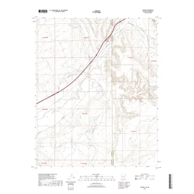
2018 Map of Lupton
USGS Topo · Published 2018About this map
Lupton sits at a critical high-desert transit point where the Puerco River cuts through the high plateaus of the Arizona-New Mexico border. This modern survey illustrates the enduring importance of this corridor, where modern 40 and historical routes like 666 follow the river's path through the red rock landscape. The map detail highlights a network of vital water sources in an arid environment, including Slims Spring, Sagebrush Spring, and Keetseli Spring, which have long supported local habitation and livestock. Away from the primary roads, the terrain is defined by dramatic geography such as Wild Goat Canyon and Surrender Canyon, while local landmarks like the Jones Ranch School and the Chi Chil Tah area reflect the community infrastructure of the Fort Defiance Agency. The transition from Apache County to McKinley County across the state line is clearly marked, showing the integration of road networks like Indian Rte 12 and Lupton Rd across jurisdictions.
Find a feature on this map
43 named features on this map. Tap any name to fly to it.
Don’t see what you’re looking for? This feature index may not catch every label — zoom into the map to look around manually.
Map Details
Editions of this 2018 Lupton Map
This is the sole edition of this map. No revisions or reprints were ever made.
Other maps of this area

1886 · Wingate
USGS Topo · 1:250,000

1886 · Fort Defiance
USGS Topo · 1:250,000

1892 · Fort Defiance
USGS Topo · 1:250,000

1892 · Wingate
USGS Topo · 1:250,000

1954 · Gallup
USGS Topo · 1:250,000

1958 · Gallup
USGS Topo · 1:250,000

1959 · Gallup
USGS Topo · 1:250,000

1962 · Gallup
USGS Topo · 1:250,000

1963 · Manuelito
USGS Topo · 1:24,000

1963 · Jones Ranch School
USGS Topo · 1:24,000
Featured Places
- Fort Defiance Agency
- Eastern Navajo Agency, NM
- Lupton, Fort Defiance Agency
- McKinley County, NM
- Apache County, AZ