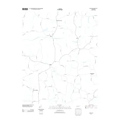
2013 Map of Luray
USGS Topo · Published 2013About this map
Luray and Huron sit at the center of this rural West Tennessee landscape, where the N Fork Forked Deer River and its various tributaries define the movement of local traffic. The settlement pattern is largely shaped by the drainage of Middle Fork Cr and Cypress Cr, with small communities like Mifflin and New Friendship serving as local hubs. The road network reflects a history of small rural institutions, evidenced by labels like Browns School Rd and Truett Schoolhouse Rd, pointing toward former educational sites in Henderson County. Farther north, Russell Crossroads and the Jackson Range Station mark important local landmarks in this agricultural region. The map preserves a network of family-named lanes and roads, such as Station Rd and John Pope Rd, which offer a clear view of the area's land ownership and social geography in the early 21st century.
Find a feature on this map
81 named features on this map. Tap any name to fly to it.
Don’t see what you’re looking for? This feature index may not catch every label — zoom into the map to look around manually.
Map Details
Editions of this 2013 Luray Map
This is the sole edition of this map. No revisions or reprints were ever made.
Other maps of this area

1936 · Lexington
USGS Topo · 1:24,000

1936 · Enville
USGS Topo · 1:24,000

1936 · Life
USGS Topo · 1:24,000

1950 · Life
USGS Topo · 1:24,000

1950 · Enville
USGS Topo · 1:24,000

1950 · Lexington
USGS Topo · 1:24,000

1953 · Claybrook
USGS Topo · 1:24,000

1953 · Beech Bluff
USGS Topo · 1:24,000

1955 · Luray
USGS Topo · 1:24,000

1955 · Juno
USGS Topo · 1:24,000