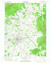
1965 Map of Luray
USGS Topo · Published 1966About this map
Luray sits at the heart of this mid-century landscape, positioned between the steep ridges of Massanutten Mountain to the west and the rising slopes of Shenandoah National Park to the east. The town serves as a hub for both industry and tourism, evidenced by the presence of the Norfolk and Western railway and world-famous natural landmarks like Luray Caverns. The survey details the winding course of the Shenandoah River South Fork as it snakes north toward Oak Hill, past the Shenandoah River Lodge. High-ground features like the Kennedy Peak Lookout Tower overlook the valley floor, which is dotted with rural centers of life including Fletcher Chapel and Beahms Chapel. A clear pattern of agricultural settlement is visible along the tributaries of Hawksbill Creek, where small schoolhouses and churches like Beth Eden Ch anchored the surrounding farmsteads.
Find a feature on this map
59 named features on this map. Tap any name to fly to it.
Don’t see what you’re looking for? This feature index may not catch every label — zoom into the map to look around manually.
Map Details
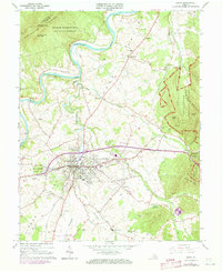
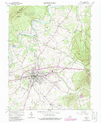
Editions of this 1965 Luray Map
3 editions found
Other maps of this area

1892 · Woodstock
USGS Topo · 1:125,000

1893 · Luray
USGS Topo · 1:125,000

1905 · Luray
USGS Topo · 1:125,000

1923 · Edinburg
USGS Topo · 1:62,500

1929 · Stony Man
USGS Topo · 1:48,000

1933 · Stony Man
USGS Topo · 1:62,500

1942 · Mt Jackson
USGS Topo · 1:62,500

1946 · Mt Jackson
USGS Topo · 1:62,500

1947 · Mt Jackson
USGS Topo · 1:62,500

1947 · Strasburg
USGS Topo · 1:62,500