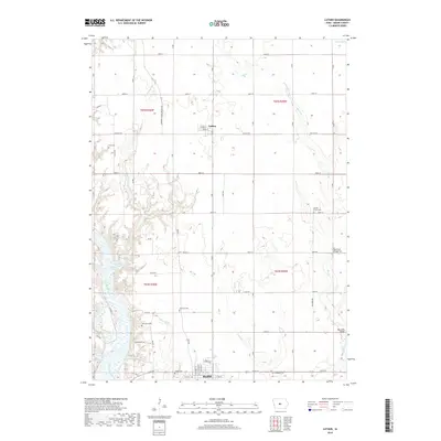
2018 Map of Luther
USGS Topo · Published 2018About this map
Madrid and Luther anchor this landscape in southern Boone County, situated along a network of agricultural roads and watercourses. The southwest corner is dominated by the winding course of the Des Moines River, where it is joined by several tributaries including Eversoll Cr and Caton Br. The drainage pattern across the central and eastern portions of the map is defined by Little Cr and Big Cr, the latter of which features distinct infrastructure points like Big Creek Bridge Two.
Find a feature on this map
45 named features on this map. Tap any name to fly to it.
Don’t see what you’re looking for? This feature index may not catch every label — zoom into the map to look around manually.
Map Details
Editions of this 2018 Luther Map
This is the sole edition of this map. No revisions or reprints were ever made.
Other maps of this area

1911 · Madrid
USGS Topo · 1:62,500

1911 · Slater
USGS Topo · 1:62,500

1912 · Ames
USGS Topo · 1:62,500

1913 · Slater
USGS Topo · 1:62,500

1914 · Madrid
USGS Topo · 1:62,500

1914 · Ames
USGS Topo · 1:62,500

1916 · Boone
USGS Topo · 1:62,500

1954 · Waterloo
USGS Topo · 1:250,000

1954 · Des Moines
USGS Topo · 1:250,000

1955 · Waterloo
USGS Topo · 1:250,000