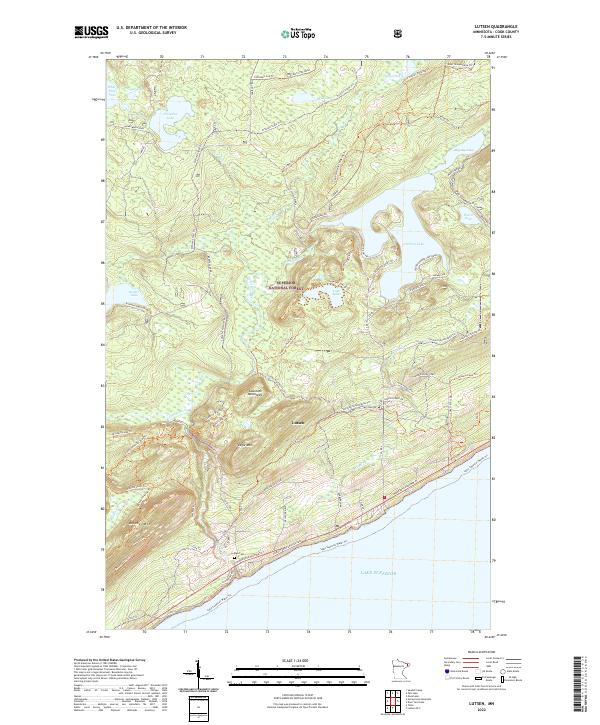
2022 Map of Lutsen
USGS Topo · Published 2022About this map
The Sawtooth Mountains dominate this 2022 survey of the North Shore, where the terrain rises sharply from the cold waters of Lake Superior. Centered on the settlement of Lutsen, the map shows a landscape defined by its glacial history and modern recreation within the Superior National Forest. Notable peaks such as Eagle Mtn and Moose Mtn provide the backdrop for a dense network of trails, including the Superior Hiking Trl and the N Shore State Trl. Inland, numerous water bodies like Caribou Lake and Lake Agnes feed into drainage systems like the Poplar River and Tait River. This map documents the intersection of old logging routes and modern wilderness access, from the Caribou Trail to the Honeymoon Trail, and includes the local Lutsen Cem near the shoreline.
Find a feature on this map
74 named features on this map. Tap any name to fly to it.
Don’t see what you’re looking for? This feature index may not catch every label — zoom into the map to look around manually.
Map Details
Editions of this 2022 Lutsen Map
This is the sole edition of this map. No revisions or reprints were ever made.
Other maps of this area

1919 · Brule Lake
USGS Topo · 1:62,500

1919 · Lutsen
USGS Topo · 1:62,500

1954 · Two Harbors
USGS Topo · 1:250,000

1955 · Tofte
USGS Topo · 1:24,000

1955 · Tofte
USGS Topo · 1:62,500

1957 · Two Harbors
USGS Topo · 1:250,000

1958 · Two Harbors
USGS Topo · 1:250,000

1958 · Deer Yard Lake
USGS Topo · 1:24,000

1959 · Lutsen
USGS Topo · 1:24,000

1960 · Tait Lake
USGS Topo · 1:24,000